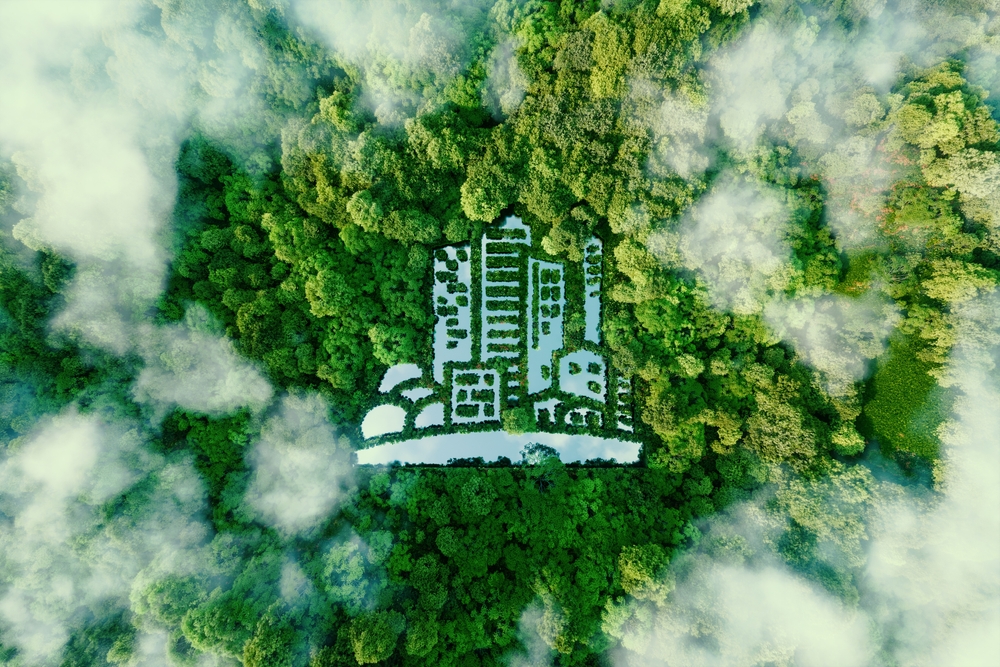
Houston, we need to save the planet!
You can’t solve a problem that doesn’t exist.
Over the last few decades, scientists have been determined to obtain evidence of global warming that will convince policymakers around the world to make the transition to a green economy. Political leaders such as the United States’ Donald Trump and Brazil’s Jair Bolsonaro have considered climate change “nonexistent”, “an expensive hoax” or even “a Marxist plot” directed by China. Nonetheless, global warming is a scientific reality and one that is endangering the lives of millions of people all around the world.
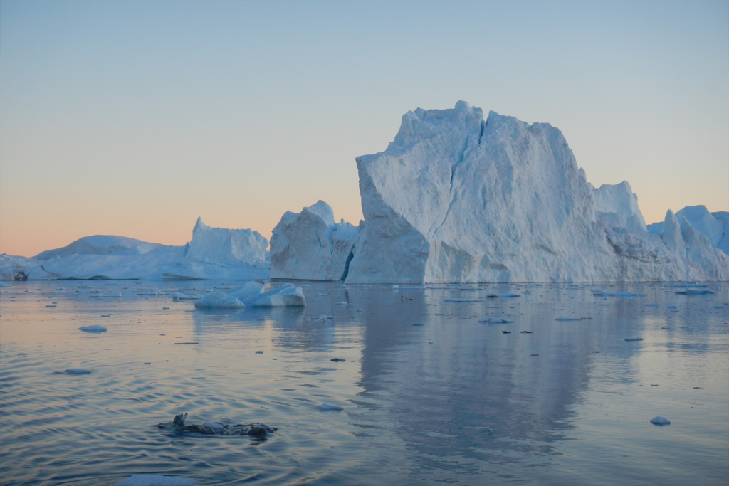
Over 90% of global warming is actually ocean warming, which directly causes sea-level rise. As the Earth heats up and glaciers melt, the amount of water in the oceans increases and expands. Scientists estimate that every centimetre of sea-level rise exposes almost three million more people in the world to flooding. A shocking number, especially when taking into account that the global sea-level has risen nine centimetres in the last 30 years.
“There is unequivocal evidence, all around the world that the Earth is warming,” says Dr Craig Donlon, from the European Space Agency (ESA). “Our climate predictions now reveal unprecedented change is just around the corner. If steps are not taken immediately, then we expect significant societal problems in terms of water security, food security and indeed societal security.”
But where do these predictions come from?
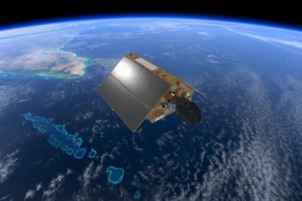
Last November, the Sentinel-6 Michael Freilich satellite was launched from California’s Vandenberg Air Force Base. It’s the latest in a series of satellites that have been monitoring the Earth’s oceans from the sky for the last three decades. Topex-Poseidon, the first of them, was launched in 1992, and later followed by Jason-1, Jason-2, Jason-3 and, now, Sentinel-6, previously known as Jason-CS but renamed after the death of NASA’s Earth Science Division Director, Michael Freilich.
“The reason climate change is so hard to predict is that we’ve never watched it before,” says Dr Josh Willis of NASA’s Jet Propulsion Laboratory. “These satellites measure the height of the ocean every second, so you can actually see global sea-level change every 10 days, and we are using this data to track the rise of the oceans due to human-caused global warming.”
Willis and Donlon are the project scientists for the Sentinel-6 mission and together they have overseen the development of the satellite from both sides of the pond. Alongside them, members of NOAA, EUMETSAT, CNES, and the European Commission, as well as a consortium of 58 companies under Airbus Defence and Space Germany, have contributed to the success of the project. The satellite is also a fundamental part of the European Union’s Copernicus programme in support of climate change. “It’s a global ocean, and we need a global community to look at the data,” Willis says.
The reason climate change is so hard to predict is that we’ve never watched it before
Although all agencies involved are now fully committed to measuring global warming, this was actually not the original intention of the Topex-Poseidon mission.
“We started flying these missions to do oceanography,” Willis says. “Whenever there is a current in the ocean that lasts for several days, it tilts the ocean surface. We built these satellites to be able to measure that tilt and watch the currents as they change over time. But, because the satellites were so accurate, we were actually able to average the data together and have one of the clearest pictures of climate change you can get.”
The data collected by these satellites has shown that the rate of sea-level rise has doubled in the past 30 years. While in the 1990s sea-levels rose about two millimetres per year, by the 2010s, oceans were rising almost five millimetres each year. Although these measurements were very exact in the open ocean, the rate of error was higher near the coastlines and in the glacier borders, a problem that Sentinel-6’s altimeter aims to solve.
“Even though we scientists are pretty good at predicting global warming, we’re pretty lousy at predicting sea-level rise and the reason for that is that we don’t know how the ice sheets are going to behave in a warming world,” Willis says. “The ice sheets are a big question mark and, right now, these satellites are the exclamation point.”
Sentinel-6’s Poseidon-4 synthetic-aperture radar (SAR) altimeter is the main tool involved in the monitoring of sea-level rise. Essentially, it sends millions of radar pulses to the Earth at the speed of light. These pulses are then reflected back to Sentinel-6, which measures the time it takes for each of them to return to calculate the distance that separates the satellite from the Earth’s surface. Any variations in this distance are indicators of sea-level change.
“The altimeter is like a really big clock in space,” Donlon says. “Poseidon-4 is the best altimeter we’ve ever built. As an altimeter, it’s capable of measuring a distance of less than 1cm from 1,336km away, so that’s pretty cool. But that alone is not enough, we need to know where the satellite is in space. To do that we have a Global Navigation Satellite System [GNSS], which is basically GPS.”
The GNSS confirms where Sentinel-6 is in space and provides the necessary data to pinpoint sea-level rise to a certain area. Moreover, it’s also helpful when calibrating the satellite, as the other devices used to check Sentinel-6’s position from the ground are referenced to the same GNSS/GPS system. Sentinel-6 also has a Radio Occultation (RO) device , an antenna that scans through the atmosphere. By measuring the air’s resistance to its signal, the RO can figure out its temperature and humidity. These tools are incredibly useful for not only making predictions around global warming, but also weather conditions.
“The ocean is actually one of the most important things for driving the climate around the planet,” Willis explains. “The best examples of this are hurricanes. Hurricanes get their heat and their energy from the ocean, so when a hurricane moves over a hotspot, it can actually speed up and go from a category one or two to a category four or five.”
Scientists are able to locate these hotspots thanks to a surprising characteristic: height. Since warm water stands taller than cold water, Sentinel-6’s altimeter is easily capable of identifying hot water currents in the way of hurricanes and predict their size and impact. “It’s like peering into the interior of the ocean and figuring out how the heat is moving around,” Willis says.
Knowing where these hotspots are and being able to predict weather patterns is fundamental to protect the people that live in coastal areas. At the moment, around 11% of the world’s population lives in the Low Elevation Coastal Zone (coastal areas below 10mm of elevation), the highest risk area in relation to climate change. Moreover, most of these regions are not prepared to face the challenges that come with accelerated global sea-level rise, as most coastal protections are several decades old.
“Extreme sea-level events at the coast that are rare today will become more frequent in the future, which means that for many locations, the main starting point for coastal planning and decision making is information on current and future events,” Donlon says.
One of these weather patterns that is likely to worsen is the El Niño/La Niña phenomenon. El Niño is associated with cold water moving towards the Eastern Pacific, creating droughts in Australia, India and Indonesia and rainfall in the United States. La Niña, in contrast, moves warm water towards the West, provoking droughts in California and floods in northern Australia. These events do not occur every year, but their frequency and impact seem to be increasing. As a consequence of El Niño, in 2015 nearly 100 million people in southern Africa, Asia and Latin America faced food and water shortages and became vulnerable to diseases such as Zika.
Sentinel-6 won’t stop these natural disasters, but it can help us be ready for them.
“El Niño is very clearly seen from the big bulge of seawater warming,” Donlon says. “The more El Niño/La Niña events that we can capture with the altimeter for the long-term record, the better prediction that we can make of what’s going to come next.”
But how trustworthy are these predictions?
Willis and Donlon wanted to answer this question, and thus put their climate model to the test. Instead of asking it to predict future weather conditions, they run the climate model backwards in time, asking it to predict past events. These predictions were then compared to independent records of altimeter data, which matched perfectly.
f steps are not taken immediately, then we expect significant societal problems in terms of water security, food security and indeed societal security
“If the climate model is able to reproduce the signals that we know exist when we run it backwards, we can trust its predictions for the future, or at least for the next 15-20 years,” Donlon says.
However, in order for these datasets to continue being useful in the future, all the variables used need to stay stable despite the satellite changes. This is achieved by keeping all the ocean observation satellites in the exact same orbit, at 1,336km over the Earth’s surface.
“The orbit is special because it’s always the same,” Willis says. “And that was actually a big deal because it’s not an easy orbit to fly in. It’s very high, which means the satellite gets a lot of radiation from the Sun, and it ages more. But it was chosen back in the ’80s to understand the tides.”
When you are measuring millimetres of sea-level rise, a three-meter tide can greatly disrupt the measurements. Most satellites fly in Sun-synchronous orbits, where they can always see the Sun, which also serves as its power source. However, since tides are driven by the Sun, if Sentinel-6 or any other of the previous Jason satellites were to follow this type of orbit, they would always measure the tide at the same spots. In order to understand the impact of tides on sea-level rise, Sentinel-6 flies in a non-synchronous orbit.
“Once we chose it the idea was to stick with it because that’s how you get the most accurate data from one satellite to the next,” Willis says. “When we jump from one to the other, we are always able to fly both satellites at the same time, in the same ground track, and make sure that we understand any disagreements between them.”
This is the phase that Sentinel-6 is currently at. Until next November, both Sentinel-6 and Jason-3 will be orbiting around the Earth and measuring sea-level rise, only separated by 30 seconds. If Sentinel-6 has been calibrated properly, the data captured by both satellites over the next year will be almost identical, and Sentinel-6 will be able to continue the mission on its own.
At least, until Sentinel-6B comes into the picture.
“Sentinel-6 is the satellite so nice we built it twice”, says Willis, jokingly. “We have been very lucky so far that we have been able to string together this record number of satellites one after the other. But what’s amazing about Sentinel-6 is that we didn’t have to get lucky this time. We built it and planned it to have two satellites, to launch while the current satellite is still in good shape and to really commit to the fact that we have to keep measuring sea-level rise because it’s not going to stop any time soon.”
Sea-level rise is not stopping, but there are things we can do to slow it down. The data collected by Sentinel-6 will be used to support the Blue Economy under the European Green Deal and, one day, it will be part of the evidence used to assess how well policies and decisions made today had a tangible impact on climate change and people’s lives.
“We have to change society, its very fabric,” Donlon says. “Sentinel-6 has demonstrated the importance of working together to try to bring the evidence base that policy-makers need to make good decisions, because the investments that need to be committed now will have a very long-reaching impact, far into the future. Without that, we’re lost.”